
North Jetty walkway demolition access planning
January/February 2017
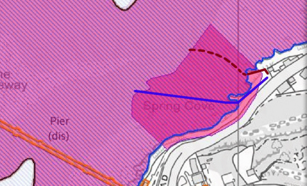
The following is a screenshot of the access planning map available from NSC's planning portal:
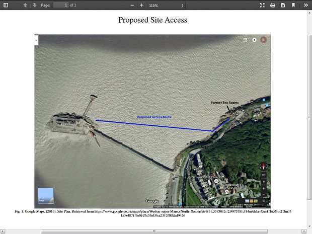
The BRT has since determined that the line of the intended route, shown in blue, is actually misplaced on the image. The true line, which leads to the landside end of low-tide causeway, is shown below in dark red:
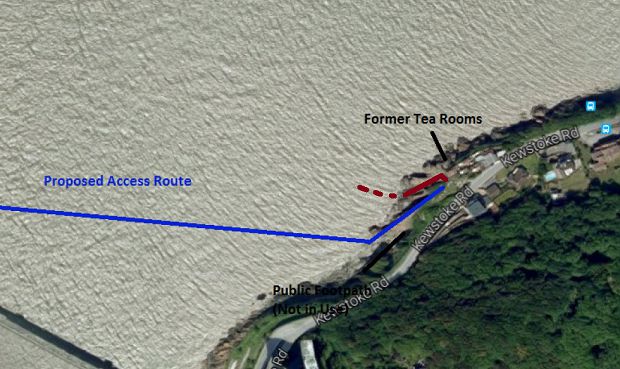
It would appear that this mapping error has led to a certain misbelief that the accessway is intended to enter Spring Cove proper - a local foreshore site of Special of Special Scientific Interest - via the pebbled bay there.
(Please see the Trust's website page concerning Spring Cove for further details about this site.)
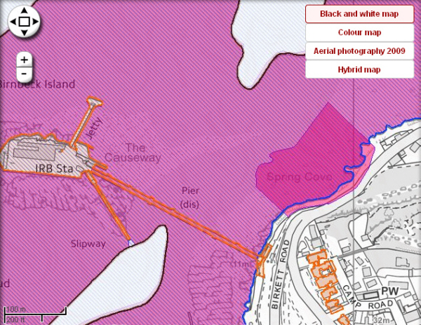
As seen on that page, the extent of the notified area of the Spring Cove SSSI can be clearly determined from use of NSC's planning portal.
© NSC/Ordnance Survey
The following cropped and edited image shows the two differing routes, the dark red line being correct, this accurately plotted upper or more northern route taking a path much further away from the important Dinantian volcanic rock and Spring Cove itself:
© NSC/Ordnance Survey
Return to the Project page


